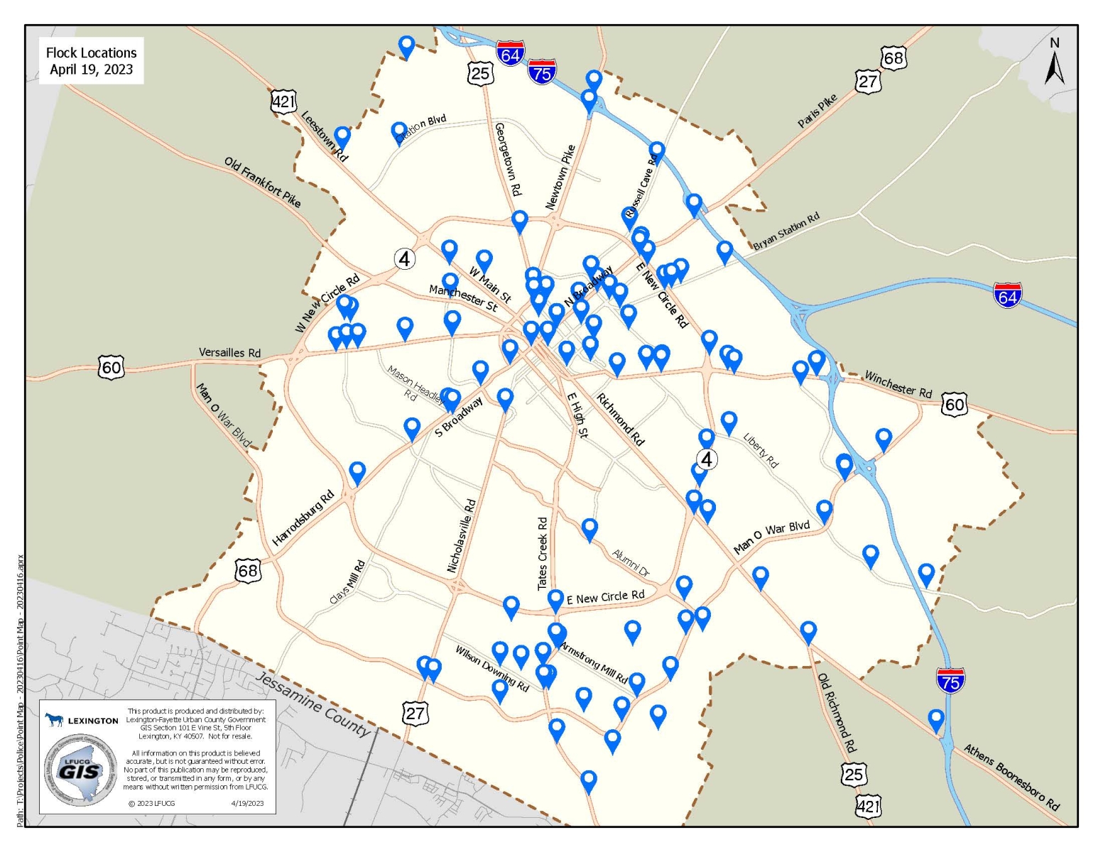
The License Plate Readers (LPRs) are placed in multiple locations throughout Lexington based on a review of crimes reported to us by victims with our crime analysts and Flock Safety. Data of crimes reported to us was used to determine the locations and does not include traffic stops, officer-initiated activity or other enforcement actions. LPRs are directed at vehicles traveling on a public right of way. The LPRs are used to gather leads to investigate crimes reported to us, not for enforcement in neighborhoods.
Below is a map of LFUCG-owned LPR locations in Fayette County.
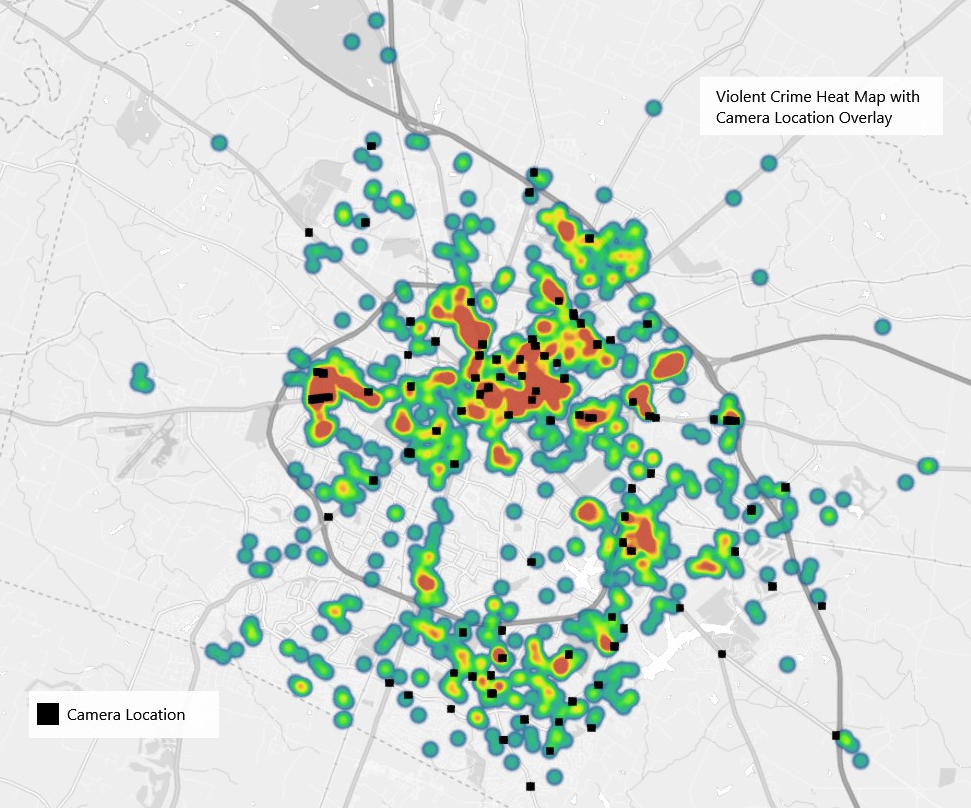
The map below was created to help show reported violent crimes and the locations of the LPRs. Varying colors represent data points on the map. The colors change from blue to red to yellow as more violent crimes are reported in an area.
License plate readers (LPRs) by council district
Chief Weathers released the information below on February 24, 2023, to the Urban County Council to help answer questions about the placement of Flock license plate readers, how many license plate readers are in each district, and how many additional LPRs are planned for each council district.
The placement of license plate readers were not determined by council districts but were determined by examining violent crime data reported by victims from July 2020 to December 2022. The types of violent crimes included are murder, rape, robbery, sexual assault, first and second-degree assault, stalking, strangulation, violation of a protective order and violation of a stalking order.
The map below was created to help show the data of reported violent crimes by location. Council districts were added at the request of the Urban County Council. Varying colors represent data points on the map. The colors change from blue to red to yellow as more violent crimes are reported in an area.

The second map uses data points as circles to represent violent crimes that victims reported. Actual violent crime numbers are listed if more than one violent crime was reported within a specific area. Council districts were added at the request of the Urban County Council.

Number of LPRs by council district
The first chart shows the number of LPRs by council district as of December 17, 2021. As part of the pilot program, the placement for the first 25 license plate readers were chosen on December 17, 2021. Council districts were redistricted after that date.
The second chart shows the current number of LPRs in each council district after the redistricting.
The third chart shows the proposed number of LPRs that will be added to each council district as part of the 75 additional license plate readers approved by the Urban County Council in December 2022.
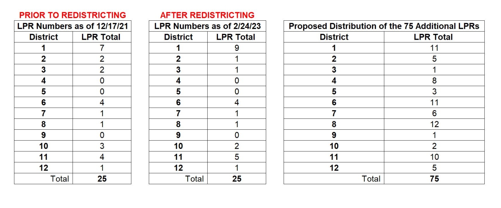
Please note: several LPRs are on the boundaries of council districts with major roadways and may capture images of vehicles traveling in the neighboring district.